Montrose Colorado Stake Trek 2026
Directions to Trek Site
Driving Directions
Quick, printable route details with a map and turn-by-turn steps.
Route Summary
From
The Church of Jesus Christ of Latter-day Saints, 1521 S Hillcrest Dr, Montrose, CO 81401
To
County Rd M44, Placerville, CO 81430
Primary
US-550 S → CO-62 W → CO-145 N → M44 Rd (Specie Creek Rd) → Beef Trail Rd
Tip: Cell service can be spotty. Consider saving the route offline before you go.
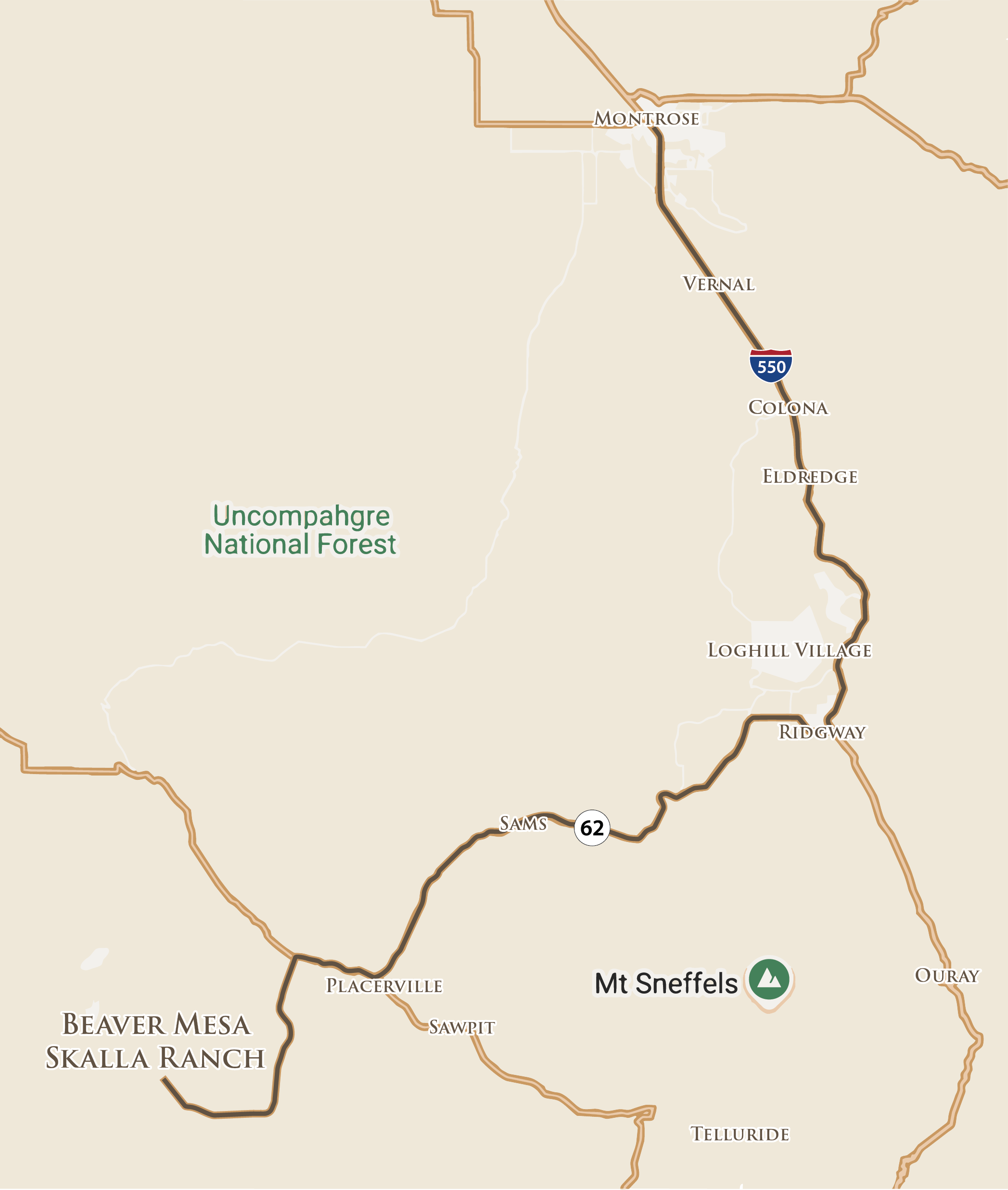
Map view of the route. For live navigation, use the Google Maps button above.
Turn-by-Turn Steps
-
1. Head toward Winston Way0.2 mi
-
2. At the traffic circle, turn right onto E Niagara Rd0.5 mi
-
3. Use the left 2 lanes to turn left onto US-550 S (S Townsend Ave)25.2 miContinue to follow US-550 S. Pass by Taco Bell (on the right in about 0.2 mi).
-
4. Turn right onto CO-62 W (State Hwy 62 / Sherman St)23.3 miContinue to follow CO-62 W (State Hwy 62).
-
5. Continue onto CO-145 N2.9 mi
-
6. Turn left onto M44 Rd (Specie Creek Rd)6.3 mi
-
7. Slight right onto Beef Trail Rd (M44 Rd / Specie Creek Rd)4.4 miContinue to follow Beef Trail Rd (M44 Rd).